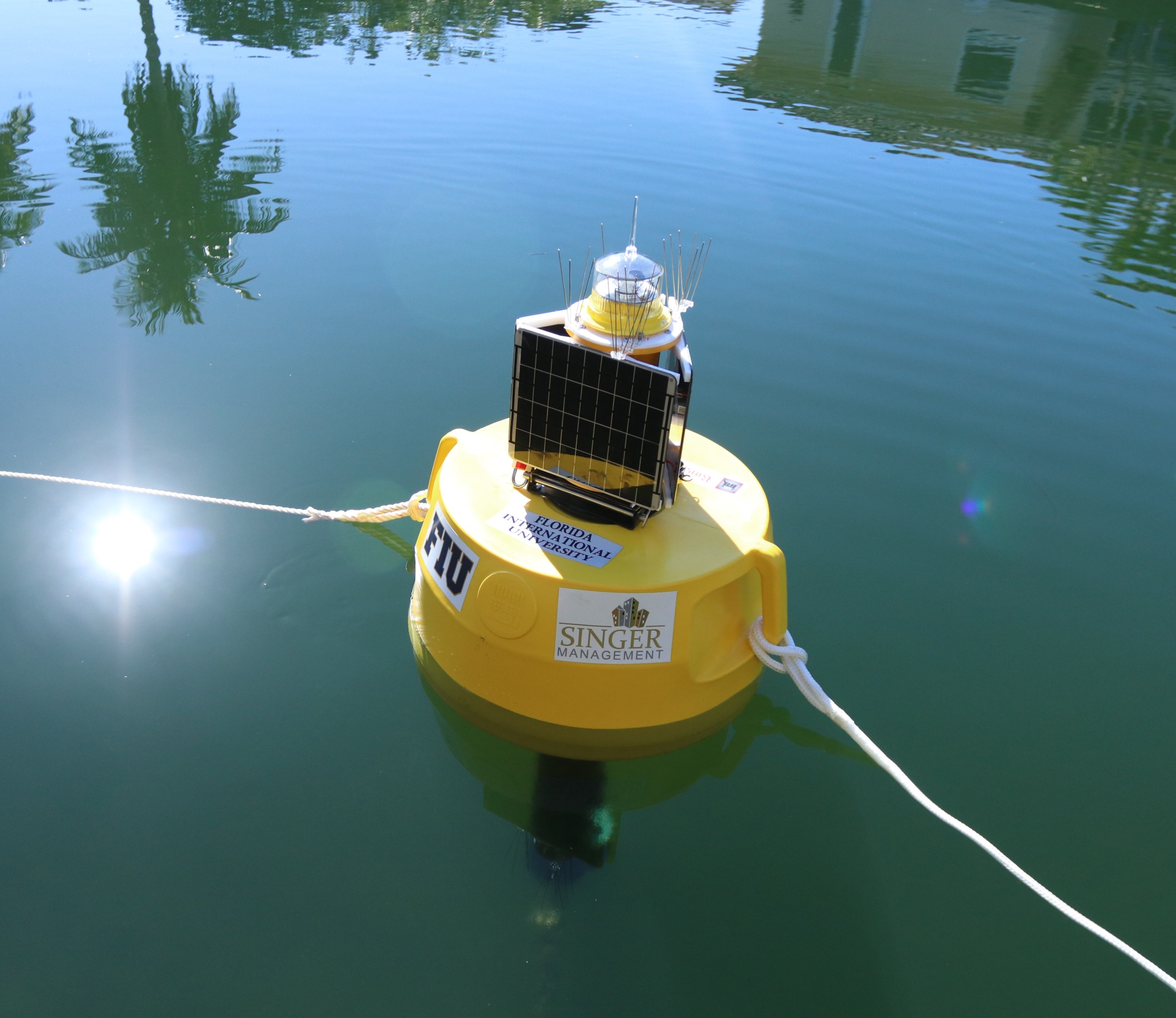
In our mission to address the complex issues of environmental contamination in South Florida, we feature cutting-edge technology in contaminant detection, monitoring and analysis. Central to this are our three Research Buoys, which were specially-designed to be deployed in both shallow freshwater ecosystems and near-shore marine environments.
The buoys' water quality parameters include:
- pH
- Temperature
- Conductivity (for salinity)
- Dissolved oxygen
- Turbidity
- Chlorophyll
- Fluorescent Dissolved Organic Matter (fDOM)
- Directional flow speed
All sensors are maintained automatically by a self-cleaning wiper system that prevents biofouling and allows for long-term deployment. The buoys are equipped with a set of solar panels which recharge the central battery and can extend sampling periods to several months. Data is collected and transmitted via cellular uplink every 15 minutes, making the information available in nearly real-time to our team and the general public.
Royal Castle / Singer Buoy: Biscayne Canal
Funded by Royal Castle Companies and Singer Management, our newest buoy fills a data gap that has been a focus since the 2020 fish kill: the Biscayne Canal. Along with our buoys in the Miami River and Little River, this deployment helps us monitor the main waterways that flow into northern Biscayne Bay. It was also the first of a new buoy model added in 2023, measuring all the same water quality and flow parameters but in a more compact and energy-efficient design.
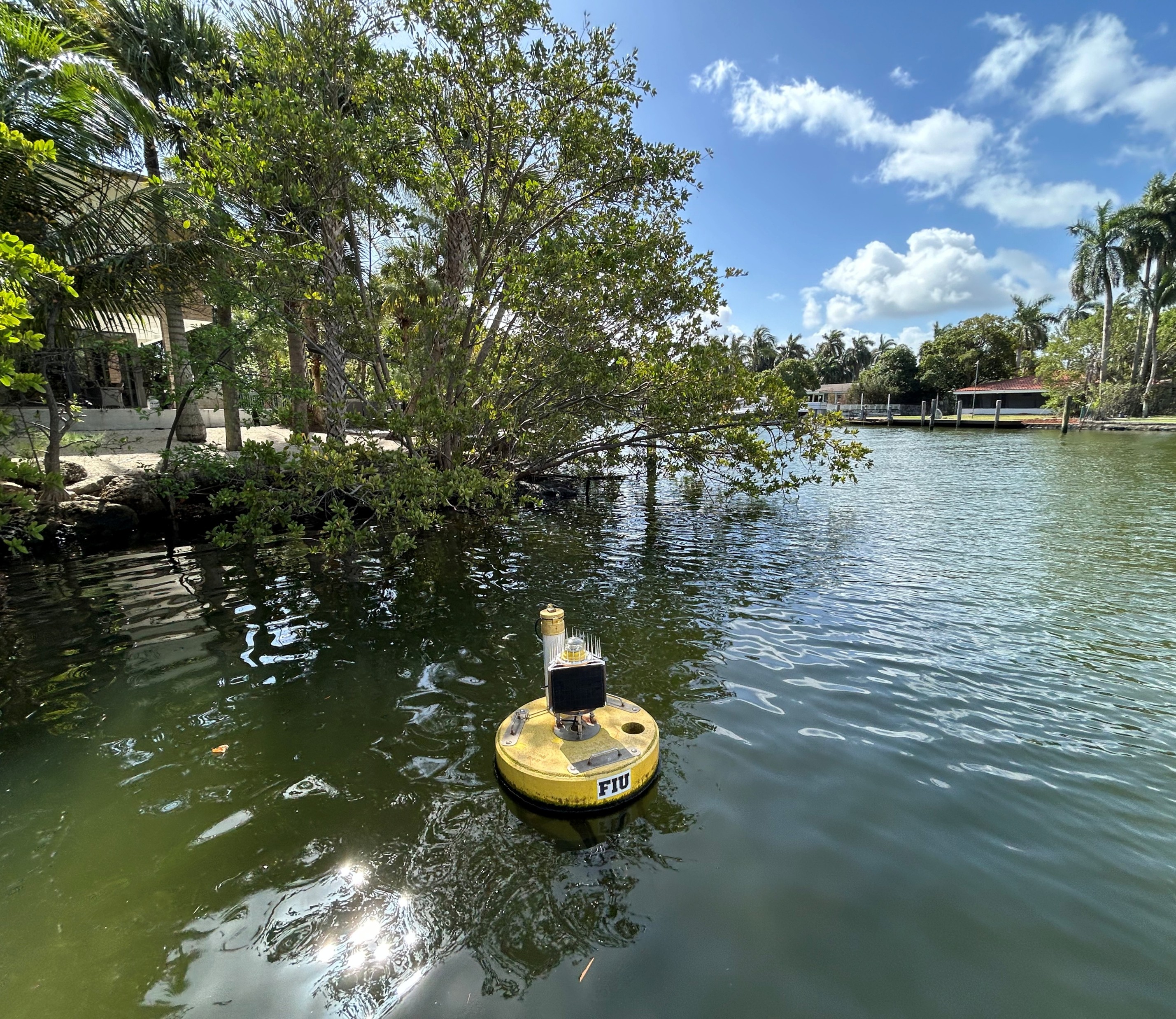
CREST Buoy 3: Little River
Indications of low-oxygen water in nearby canals leading into Biscayne Bay prompted us to deploy a buoy in the Little River. Previously CREST 2, this buoy site plays a key role in monitoring the quality and quantity of urban water flowing into the Bay, and can help give early warnings of any changes in the local water conditions. CREST Buoy 3 is located near the Little River Pocket Park, where FIU teams have previously measured sunny day flooding and collected water samples for contamination testing.
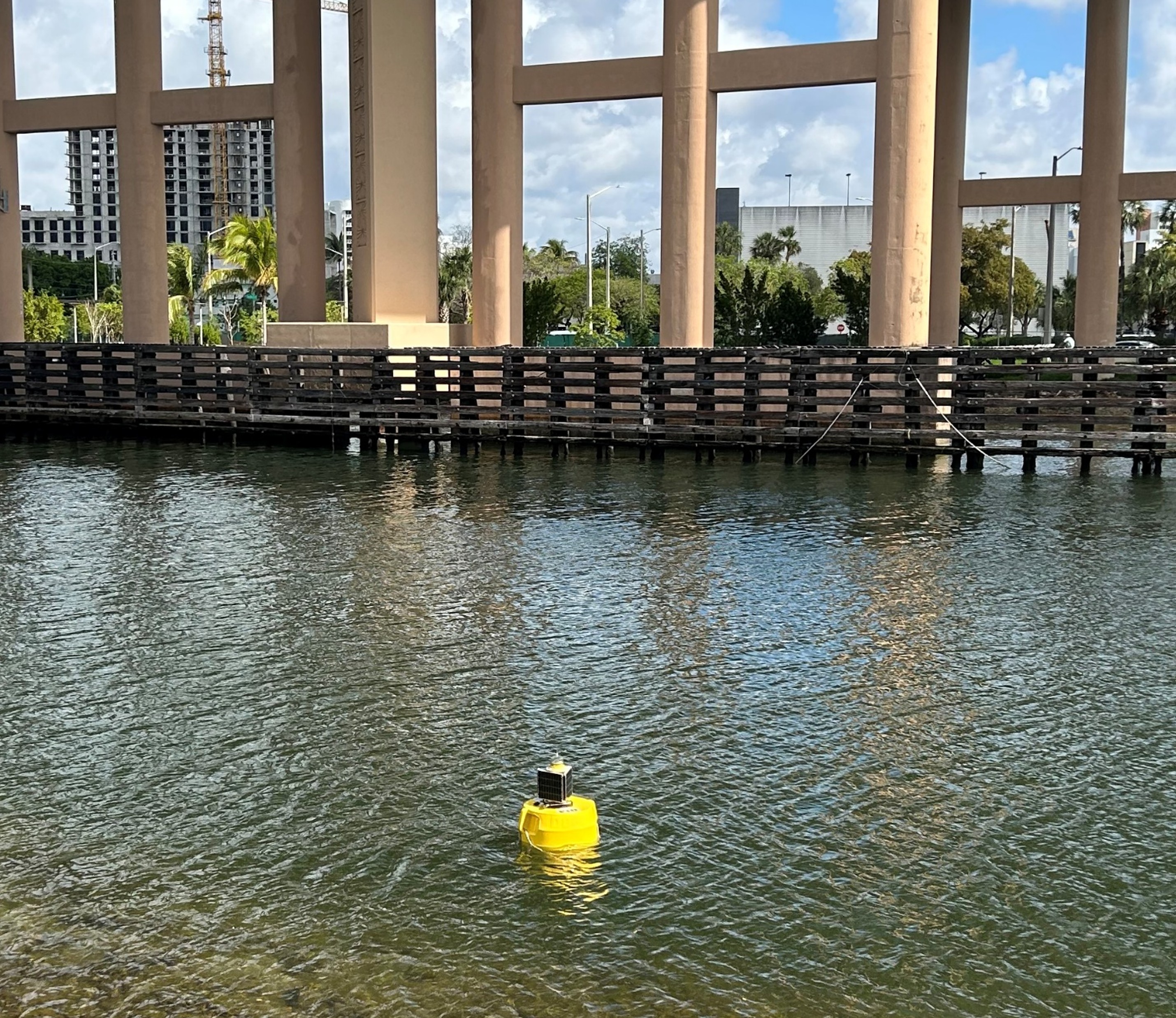
CREST Buoy 4: Miami River
First deployed in early 2020, the Miami River buoy monitors conditions in one of south Florida's most polluted waterways. Previously CREST 3, this site helps cover some of the main sources of water flowing into northern Biscayne Bay. The buoy takes meaurements every 15 minutes and automatically transmits all data live for public viewing. Parameters include temperature, conductivity, salinity, dissolved oxygen, pH, turbidity, chlorophyll-a, fluorescent dissolved organic matter, as well as the speed and direction of water flow.
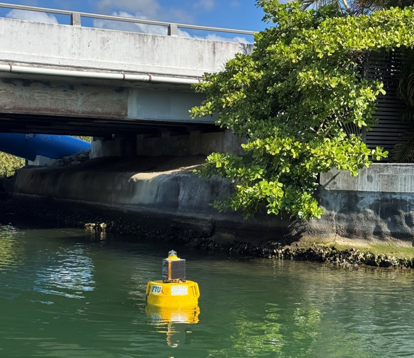
CREST Buoy 5: Coral Gables Waterway
Our longest continuous buoy site to date, this deployment in the Coral Gables waterway began with CREST 1 in early January 2019. Mutliple CREST Fellows have been involved in its maintenance and data usage over the years, including Matt Smith, Marbelys Garriga, and Liz Ortiz Munoz. The buoy monitors water quality and flow in a managed, urban canal system to compare normal conditions with extremes, such as during heavy rain events and king tides.
Past Deployments
North Biscayne Bay
With other CREST buoys deployed in the waterways that feed Biscayne Bay, our next priority was to re-deploy a buoy back into the Bay itself. CREST Buoy 4 was placed in the Julia Tuttle basin just south of North Bay Village, where water quality incidents had reocurred since the August 2020 fish kill. This buoy gave us eyes on a critical area that had been raising alarms for conditions throughout the Bay.
North Bay Village
Reports of fish kills and algal blooms in Biscayne Bay (August 2020) prompted us to deploy our water quality buoys in an effort to identify what is happening below the surface. These buoys represent a key part of our efforts to understand devastating impacts on our natural environments when they coincide with our urban systems. This site was chosen in an area of Biscayne Bay that experienced very high water temperatures and extrememly low dissolved oxygen readings.
Heart Harbor
In response to local concerns, a buoy was deployed in 2019 at “Heart Harbor” of Tavernier, Florida. Dissolved oxygen and chlorophyll levels were the primary focus, after a species of toxic algae was confirmed following a fish kill in the harbor. This effort was thanks to the awareness and actions of local citizens, along with our researchers who responded by taking samples for early analysis.
Haulover Mangroves
After deploying our first research buoy in 2018 at Haulover Inlet, we later placed another buoy nearby to draw comparisons in the surrounding water quality and flow data. This second site was located in shallower waters close to a mangrove forest near FIU's Biscayna Bay Campus. In addition to providing data comparisons, this buoy also gave us some baseline information on a mangrove ecosystem.
Haulover Inlet
Our very first deployment was in Haulover Inlet near FIU's Biscayne Bay Campus. This buoy was deployed in October 2018 in response to a red tide outbreak on the southeast coast of Florida. After the initial concerns had passed, the buoy stayed to continue taking measurements and help signal other potential changes in water quality. In August 2020, an emergency fish kill situation arose and this buoy was relocated further south in Biscayne Bay to assist in our monitoring efforts.